[fusion_builder_container hundred_percent=“no“ hundred_percent_height=“no“ hundred_percent_height_scroll=“no“ hundred_percent_height_center_content=“yes“ equal_height_columns=“no“ menu_anchor=““ hide_on_mobile=“small-visibility,medium-visibility,large-visibility“ class=““ id=““ background_color=““ background_image=““ background_position=“center center“ background_repeat=“no-repeat“ fade=“no“ background_parallax=“none“ enable_mobile=“no“ parallax_speed=“0.3″ video_mp4=““ video_webm=““ video_ogv=““ video_url=““ video_aspect_ratio=“16:9″ video_loop=“yes“ video_mute=“yes“ video_preview_image=““ border_size=““ border_color=““ border_style=“solid“ margin_top=““ margin_bottom=““ padding_top=““ padding_right=““ padding_bottom=““ padding_left=““][fusion_builder_row][fusion_builder_column type=“1_2″ spacing=““ center_content=“no“ link=““ target=“_self“ min_height=““ hide_on_mobile=“small-visibility,medium-visibility,large-visibility“ class=““ id=““ background_color=““ background_image=““ background_position=“left top“ background_repeat=“no-repeat“ hover_type=“none“ border_size=“0″ border_color=““ border_style=“solid“ border_position=“all“ padding=“undefined“ dimension_margin=“undefined“ animation_type=““ animation_direction=“left“ animation_speed=“0.3″ animation_offset=““ last=“no“][fusion_text columns=““ column_min_width=““ column_spacing=““ rule_style=“default“ rule_size=““ rule_color=““ class=““ id=““]In diesem Artikel zeigen wir ihnen welche Vorteile das Erfassen einer Baustelle mit einer UAV und 3Dsurvey hat.
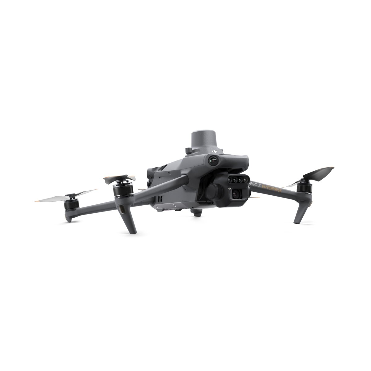
Wir werden ihnen alle notwendigen Schritte aufzeigen, wie Sie zukünftig eine Baufortschrittsüberwachung mit einer UAV (DJI P4RTK) einem GNSS Receiver (Emlid Reach RS2) und 3Dsurvey durchführen können.[/fusion_text][/fusion_builder_column][fusion_builder_column type=“1_2″ spacing=““ center_content=“no“ link=““ target=“_self“ min_height=““ hide_on_mobile=“small-visibility,medium-visibility,large-visibility“ class=““ id=““ background_color=““ background_image=““ background_position=“left top“ background_repeat=“no-repeat“ hover_type=“none“ border_size=“0″ border_color=““ border_style=“solid“ border_position=“all“ padding=“undefined“ dimension_margin=“undefined“ animation_type=““ animation_direction=“left“ animation_speed=“0.3″ animation_offset=““ last=“no“][fusion_imageframe image_id=“16046″ max_width=““ style_type=“none“ stylecolor=““ hover_type=“none“ bordersize=““ bordercolor=““ borderradius=““ align=“none“ lightbox=“no“ gallery_id=““ lightbox_image=““ alt=““ link=““ linktarget=“_self“ hide_on_mobile=“small-visibility,medium-visibility,large-visibility“ class=““ id=““ animation_type=““ animation_direction=“left“ animation_speed=“0.3″ animation_offset=““]https://staging.caddy-geomatics.de/wp-content/uploads/2021/04/3Dmesh.png[/fusion_imageframe][/fusion_builder_column][/fusion_builder_row][/fusion_builder_container][fusion_builder_container hundred_percent=“no“ hundred_percent_height=“no“ hundred_percent_height_scroll=“no“ hundred_percent_height_center_content=“yes“ equal_height_columns=“no“ menu_anchor=““ hide_on_mobile=“small-visibility,medium-visibility,large-visibility“ class=““ id=““ background_color=““ background_image=““ background_position=“center center“ background_repeat=“no-repeat“ fade=“no“ background_parallax=“none“ enable_mobile=“no“ parallax_speed=“0.3″ video_mp4=““ video_webm=““ video_ogv=““ video_url=““ video_aspect_ratio=“16:9″ video_loop=“yes“ video_mute=“yes“ video_preview_image=““ border_size=““ border_color=““ border_style=“solid“ margin_top=““ margin_bottom=““ padding_top=““ padding_right=““ padding_bottom=““ padding_left=““][fusion_builder_row][fusion_builder_column type=“1_1″ spacing=““ center_content=“no“ link=““ target=“_self“ min_height=““ hide_on_mobile=“small-visibility,medium-visibility,large-visibility“ class=““ id=““ background_color=““ background_image=““ background_position=“left top“ background_repeat=“no-repeat“ hover_type=“none“ border_size=“0″ border_color=““ border_style=“solid“ border_position=“all“ padding=“undefined“ dimension_margin=“undefined“ animation_type=““ animation_direction=“left“ animation_speed=“0.3″ animation_offset=““ last=“no“][fusion_text columns=““ column_min_width=““ column_spacing=““ rule_style=“default“ rule_size=““ rule_color=““ class=““ id=““]
Problemstellung & Lösung
In unserem Fall handelt sich um ein sehr großes Abrissgelände. Die Fläche beträgt ca. 400.000 m² und das Volumen der Gebäude um die 1.000.000 m³.[/fusion_text][fusion_images picture_size=“auto“ hover_type=“zoomin“ autoplay=“no“ columns=“3″ column_spacing=“13″ scroll_items=““ show_nav=“yes“ mouse_scroll=“no“ border=“yes“ lightbox=“no“ hide_on_mobile=“small-visibility,medium-visibility,large-visibility“ class=““ id=““][fusion_image image=“https://staging.caddy-geomatics.de/wp-content/uploads/2021/04/Stand-1.png“ image_id=“16054″ link=““ linktarget=“_self“ alt=““ /][fusion_image image=“https://staging.caddy-geomatics.de/wp-content/uploads/2021/04/Stand-2.png“ image_id=“16055″ link=““ linktarget=“_self“ alt=““ /][fusion_image image=“https://staging.caddy-geomatics.de/wp-content/uploads/2021/04/Stand-3.png“ image_id=“16056″ link=““ linktarget=“_self“ alt=““ /][/fusion_images][fusion_text columns=““ column_min_width=““ column_spacing=““ rule_style=“default“ rule_size=““ rule_color=““ class=““ id=““]
Problemstellung für die klassische Vermessung
• Die Einzelpunktaufnahme wäre zu zeitintensiv.
• zu viele Details
• Die Präsentation der Resultate anhand eines 3D Lageplans war für den Auftraggeber nicht ausreichend.[/fusion_text][/fusion_builder_column][/fusion_builder_row][/fusion_builder_container][fusion_builder_container hundred_percent=“no“ hundred_percent_height=“no“ hundred_percent_height_scroll=“no“ hundred_percent_height_center_content=“yes“ equal_height_columns=“no“ menu_anchor=““ hide_on_mobile=“small-visibility,medium-visibility,large-visibility“ class=““ id=““ background_color=““ background_image=““ background_position=“center center“ background_repeat=“no-repeat“ fade=“no“ background_parallax=“none“ enable_mobile=“no“ parallax_speed=“0.3″ video_mp4=““ video_webm=““ video_ogv=““ video_url=““ video_aspect_ratio=“16:9″ video_loop=“yes“ video_mute=“yes“ video_preview_image=““ border_size=““ border_color=““ border_style=“solid“ margin_top=““ margin_bottom=““ padding_top=““ padding_right=““ padding_bottom=““ padding_left=““][fusion_builder_row][fusion_builder_column type=“1_3″ spacing=““ center_content=“no“ link=““ target=“_self“ min_height=““ hide_on_mobile=“small-visibility,medium-visibility,large-visibility“ class=““ id=““ background_color=““ background_image=““ background_position=“left top“ background_repeat=“no-repeat“ hover_type=“none“ border_size=“0″ border_color=““ border_style=“solid“ border_position=“all“ padding=“undefined“ dimension_margin=“undefined“ animation_type=““ animation_direction=“left“ animation_speed=“0.3″ animation_offset=““ last=“no“][fusion_text columns=““ column_min_width=““ column_spacing=““ rule_style=“default“ rule_size=““ rule_color=““ class=““ id=““]
Lösung
UAV Daten können sehr schnell aufgenommen werden und sind wesentlich detailreicher und anschaulicher.
Es ist eine sicherere, schnellere und effizientere Möglichkeit für Bauunternehmen, die ihren Baufortschritt überwachen müssen und die Daten für Jedermann zur Verfügung zu stellen[/fusion_text][/fusion_builder_column][fusion_builder_column type=“2_3″ spacing=““ center_content=“no“ link=““ target=“_self“ min_height=““ hide_on_mobile=“small-visibility,medium-visibility,large-visibility“ class=““ id=““ background_color=““ background_image=““ background_position=“left top“ background_repeat=“no-repeat“ hover_type=“none“ border_size=“0″ border_color=““ border_style=“solid“ border_position=“all“ padding=“undefined“ dimension_margin=“undefined“ animation_type=““ animation_direction=“left“ animation_speed=“0.3″ animation_offset=““ last=“no“][fusion_youtube id=“https://youtu.be/WjgWPjdZGdk“ alignment=““ width=““ height=““ autoplay=“false“ api_params=““ hide_on_mobile=“small-visibility,medium-visibility,large-visibility“ class=““ /][/fusion_builder_column][/fusion_builder_row][/fusion_builder_container][fusion_builder_container hundred_percent=“no“ hundred_percent_height=“no“ hundred_percent_height_scroll=“no“ hundred_percent_height_center_content=“yes“ equal_height_columns=“no“ menu_anchor=““ hide_on_mobile=“small-visibility,medium-visibility,large-visibility“ class=““ id=““ background_color=““ background_image=““ background_position=“center center“ background_repeat=“no-repeat“ fade=“no“ background_parallax=“none“ enable_mobile=“no“ parallax_speed=“0.3″ video_mp4=““ video_webm=““ video_ogv=““ video_url=““ video_aspect_ratio=“16:9″ video_loop=“yes“ video_mute=“yes“ video_preview_image=““ border_size=““ border_color=““ border_style=“solid“ margin_top=““ margin_bottom=““ padding_top=““ padding_right=““ padding_bottom=““ padding_left=““][fusion_builder_row][fusion_builder_column type=“1_2″ spacing=““ center_content=“no“ link=““ target=“_self“ min_height=““ hide_on_mobile=“small-visibility,medium-visibility,large-visibility“ class=““ id=““ background_color=““ background_image=““ background_position=“left top“ background_repeat=“no-repeat“ hover_type=“none“ border_size=“0″ border_color=““ border_style=“solid“ border_position=“all“ padding=“undefined“ dimension_margin=“undefined“ animation_type=““ animation_direction=“left“ animation_speed=“0.3″ animation_offset=““ last=“no“][fusion_text columns=““ column_min_width=““ column_spacing=““ rule_style=“default“ rule_size=““ rule_color=““ class=““ id=““]
Flugplanung für Baufortschritt
Wir haben unterschiedliche Flugplanungen für die Datenaufnahme verwendet
Um den Urzustand zu dokumentieren, haben wir auf die schräge Flächen Planung der DJI P4RTK zurückgegriffen, Damit wir auch die Kamine mit abbilden können.
Die Zwischenstände im Dezember, Januar und Februar wurden aus über die 3D Flugplanung mit 70 Grad Kamerwinkel erstellt, wobei die Kamine in der Planung ausgelassen wurden.[/fusion_text][/fusion_builder_column][fusion_builder_column type=“1_2″ spacing=““ center_content=“no“ link=““ target=“_self“ min_height=““ hide_on_mobile=“small-visibility,medium-visibility,large-visibility“ class=““ id=““ background_color=““ background_image=““ background_position=“left top“ background_repeat=“no-repeat“ hover_type=“none“ border_size=“0″ border_color=““ border_style=“solid“ border_position=“all“ padding=“undefined“ dimension_margin=“undefined“ animation_type=““ animation_direction=“left“ animation_speed=“0.3″ animation_offset=““ last=“no“][fusion_imageframe image_id=“16049″ max_width=““ style_type=“none“ stylecolor=““ hover_type=“none“ bordersize=““ bordercolor=““ borderradius=““ align=“none“ lightbox=“no“ gallery_id=““ lightbox_image=““ alt=““ link=““ linktarget=“_self“ hide_on_mobile=“small-visibility,medium-visibility,large-visibility“ class=““ id=““ animation_type=““ animation_direction=“left“ animation_speed=“0.3″ animation_offset=““]https://staging.caddy-geomatics.de/wp-content/uploads/2021/04/Flugplanung1.png[/fusion_imageframe][fusion_imageframe image_id=“16050″ max_width=““ style_type=“none“ stylecolor=““ hover_type=“none“ bordersize=““ bordercolor=““ borderradius=““ align=“none“ lightbox=“no“ gallery_id=““ lightbox_image=““ alt=““ link=““ linktarget=“_self“ hide_on_mobile=“small-visibility,medium-visibility,large-visibility“ class=““ id=““ animation_type=““ animation_direction=“left“ animation_speed=“0.3″ animation_offset=““]https://staging.caddy-geomatics.de/wp-content/uploads/2021/04/Flugplanung2.png[/fusion_imageframe][/fusion_builder_column][/fusion_builder_row][/fusion_builder_container][fusion_builder_container hundred_percent=“no“ hundred_percent_height=“no“ hundred_percent_height_scroll=“no“ hundred_percent_height_center_content=“yes“ equal_height_columns=“no“ menu_anchor=““ hide_on_mobile=“small-visibility,medium-visibility,large-visibility“ class=““ id=““ background_color=““ background_image=““ background_position=“center center“ background_repeat=“no-repeat“ fade=“no“ background_parallax=“none“ enable_mobile=“no“ parallax_speed=“0.3″ video_mp4=““ video_webm=““ video_ogv=““ video_url=““ video_aspect_ratio=“16:9″ video_loop=“yes“ video_mute=“yes“ video_preview_image=““ border_size=““ border_color=““ border_style=“solid“ margin_top=““ margin_bottom=““ padding_top=““ padding_right=““ padding_bottom=““ padding_left=““][fusion_builder_row][fusion_builder_column type=“1_1″ spacing=““ center_content=“no“ link=““ target=“_self“ min_height=““ hide_on_mobile=“small-visibility,medium-visibility,large-visibility“ class=““ id=““ background_color=““ background_image=““ background_position=“left top“ background_repeat=“no-repeat“ hover_type=“none“ border_size=“0″ border_color=““ border_style=“solid“ border_position=“all“ padding=“undefined“ dimension_margin=“undefined“ animation_type=““ animation_direction=“left“ animation_speed=“0.3″ animation_offset=““ last=“no“][fusion_text columns=““ column_min_width=““ column_spacing=““ rule_style=“default“ rule_size=““ rule_color=““ class=““ id=““]
Auswertung mit 3Dsurvey
Unsere Ziele:
1. Erstellen eines Gebäudeplans aus dem Xray[/fusion_text][fusion_images picture_size=“auto“ hover_type=“zoomin“ autoplay=“no“ columns=“2″ column_spacing=“13″ scroll_items=““ show_nav=“yes“ mouse_scroll=“no“ border=“yes“ lightbox=“no“ hide_on_mobile=“small-visibility,medium-visibility,large-visibility“ class=““ id=““][fusion_image image=“https://staging.caddy-geomatics.de/wp-content/uploads/2021/04/Xray.png“ image_id=““ link=““ linktarget=“_self“ alt=““ /][fusion_image image=“https://staging.caddy-geomatics.de/wp-content/uploads/2021/04/Gebaeudeplan.png“ image_id=““ link=““ linktarget=“_self“ alt=““ /][/fusion_images][fusion_text columns=““ column_min_width=““ column_spacing=““ rule_style=“default“ rule_size=““ rule_color=““ class=““ id=““]2. Erstellen eines 3D Models für die Präsentation[/fusion_text][fusion_imageframe image_id=“16046″ max_width=““ style_type=“none“ stylecolor=““ hover_type=“zoomin“ bordersize=““ bordercolor=““ borderradius=““ align=“none“ lightbox=“no“ gallery_id=““ lightbox_image=““ alt=““ link=““ linktarget=“_self“ hide_on_mobile=“small-visibility,medium-visibility,large-visibility“ class=““ id=““ animation_type=““ animation_direction=“left“ animation_speed=“0.3″ animation_offset=““]https://staging.caddy-geomatics.de/wp-content/uploads/2021/04/3Dmesh.png[/fusion_imageframe][fusion_text columns=““ column_min_width=““ column_spacing=““ rule_style=“default“ rule_size=““ rule_color=““ class=““ id=““]3. Erstellen eines 3D Models für das Tracking des Fortschritts in den unterschiedlichen Gebieten[/fusion_text][fusion_imageframe image_id=“16065″ max_width=““ style_type=“none“ stylecolor=““ hover_type=“none“ bordersize=““ bordercolor=““ borderradius=““ align=“none“ lightbox=“no“ gallery_id=““ lightbox_image=““ alt=““ link=““ linktarget=“_self“ hide_on_mobile=“small-visibility,medium-visibility,large-visibility“ class=““ id=““ animation_type=““ animation_direction=“left“ animation_speed=“0.3″ animation_offset=““]https://staging.caddy-geomatics.de/wp-content/uploads/2021/04/Abrechnung-1.png[/fusion_imageframe][/fusion_builder_column][/fusion_builder_row][/fusion_builder_container]