
[fusion_builder_container hundred_percent=“no“ hundred_percent_height=“no“ hundred_percent_height_scroll=“no“ hundred_percent_height_center_content=“yes“ equal_height_columns=“no“ menu_anchor=““ hide_on_mobile=“small-visibility,medium-visibility,large-visibility“ class=““ id=““ background_color=““ background_image=““ background_position=“center center“ background_repeat=“no-repeat“ fade=“no“ background_parallax=“none“ enable_mobile=“no“ parallax_speed=“0.3″ video_mp4=““ video_webm=““ video_ogv=““ video_url=““ video_aspect_ratio=“16:9″ video_loop=“yes“ video_mute=“yes“ video_preview_image=““ border_size=““ border_color=““ border_style=“solid“ margin_top=““ margin_bottom=““ padding_top=““ padding_right=““ padding_bottom=““ padding_left=““][fusion_builder_row][fusion_builder_column type=“1_1″ layout=“1_1″ spacing=““ center_content=“no“ link=““ target=“_self“ min_height=““ hide_on_mobile=“small-visibility,medium-visibility,large-visibility“ class=““ id=““ background_color=““ background_image=““ background_position=“left top“ background_repeat=“no-repeat“ hover_type=“none“ border_size=“0″ border_color=““ border_style=“solid“ border_position=“all“ padding_top=““ padding_right=““ padding_bottom=““ padding_left=““ dimension_margin=““ animation_type=““ animation_direction=“left“ animation_speed=“0.3″ animation_offset=““ last=“no“][fusion_text columns=““ column_min_width=““ column_spacing=““ rule_style=“default“ rule_size=““ rule_color=““ class=““ id=““]
Besuchen Sie uns auf der InterGeo 2025 (12.0/0C047)
 [/fusion_text][/fusion_builder_column][/fusion_builder_row][/fusion_builder_container][fusion_builder_container hundred_percent=“no“ hundred_percent_height=“no“ hundred_percent_height_scroll=“no“ hundred_percent_height_center_content=“yes“ equal_height_columns=“no“ menu_anchor=““ hide_on_mobile=“small-visibility,medium-visibility,large-visibility“ class=““ id=““ background_color=““ background_image=““ background_position=“center center“ background_repeat=“no-repeat“ fade=“no“ background_parallax=“none“ enable_mobile=“no“ parallax_speed=“0.3″ video_mp4=““ video_webm=““ video_ogv=““ video_url=““ video_aspect_ratio=“16:9″ video_loop=“yes“ video_mute=“yes“ video_preview_image=““ border_size=““ border_color=““ border_style=“solid“ margin_top=““ margin_bottom=““ padding_top=““ padding_right=““ padding_bottom=““ padding_left=““][fusion_builder_row][fusion_builder_column type=“1_1″ layout=“1_1″ spacing=““ center_content=“yes“ link=““ target=“_blank“ min_height=““ hide_on_mobile=“small-visibility,medium-visibility,large-visibility“ class=““ id=““ background_color=““ background_image=““ background_position=“left top“ undefined=““ background_repeat=“no-repeat“ hover_type=“none“ border_size=“0″ border_color=““ border_style=“solid“ border_position=“all“ padding_top=““ padding_right=““ padding_bottom=““ padding_left=““ margin_top=““ margin_bottom=““ animation_type=““ animation_direction=“left“ animation_speed=“0.3″ animation_offset=““ last=“no“][fusion_accordion type=““ boxed_mode=““ border_size=“0″ border_color=““ background_color=““ hover_color=““ divider_line=““ icon_size=““ icon_color=““ icon_boxed_mode=““ icon_alignment=““ hide_on_mobile=“small-visibility,medium-visibility,large-visibility“ class=““ id=““][fusion_toggle title=“GNSS Beeinflussung durch Sonnenstürme“ open=“no“]
Aktuell beeinflusst erhöhte Sonnenaktivität die GNSS-Positionsbestimmung durch längere Initialisierungszeiten und stärkere Streuung. Dies resultiert aus Laufzeitverzögerungen in der Ionosphäre, bedingt durch Sonnenturbulenzen im etwa 11 bis 12-jährigen Zyklus. Die Sonnenaktivität steigt und erreicht voraussichtlich 2025 ihren Höhepunkt. Für präzise GNSS-Messungen wird empfohlen, Doppelmessungen zu verschiedenen Tageszeiten durchzuführen und Messungen bei starken ionosphärischen Störungen zu vermeiden. Aktueller KP-Index und Spaceweather
[/fusion_toggle][fusion_toggle title=“GNSS Manipulation (Spoofing)“ open=“no“]
In Bezug auf mögliche Manipulationen der GLONASS-Satelliten im Zusammenhang mit dem Ukraine-Konflikt besteht derzeit keine feststellbare Beeinträchtigung. Historisch gesehen haben militärische Betreiber von GNSS, einschließlich GPS und GLONASS, während Konflikten auf administrative Eingriffe verzichtet. Die Vielfalt globaler Navigationssatellitensysteme und das zivile System GALILEO bleiben unberührt. Lokale Spoofing-Angriffe im Kriegsgebiet sind bekannt, aber Deutschland ist davon nicht betroffen.
[/fusion_toggle][/fusion_accordion][fusion_text columns=““ column_min_width=““ column_spacing=““ rule_style=“default“ rule_size=““ rule_color=““ class=““ id=““]
Als CADdy Geomatics GmbH erhalten wir regelmäßig Anfragen zu den Themen GNSS-Manipulation und Sonnenstürme im Kontext der Positionsbestimmung. Zur Klarstellung für unsere Kunden haben wir diese kurze Zusammenfassung erstellt. Für weiterführende Informationen steht Ihnen unser UAS-Spezialist, Axel Dannenbauer, unter +49 (0)89 42742222 gerne zur Verfügung.
[/fusion_text][/fusion_builder_column][/fusion_builder_row][/fusion_builder_container][fusion_builder_container admin_label=“Intro“ hundred_percent=“no“ hundred_percent_height=“no“ hundred_percent_height_scroll=“no“ hundred_percent_height_center_content=“yes“ equal_height_columns=“no“ menu_anchor=““ hide_on_mobile=“no“ class=““ id=““ background_color=“#ffffff“ background_image=““ background_position=“left top“ background_repeat=“no-repeat“ fade=“no“ background_parallax=“none“ enable_mobile=“no“ parallax_speed=“0.3″ video_mp4=““ video_webm=““ video_ogv=““ video_url=““ video_aspect_ratio=“16:9″ video_loop=“yes“ video_mute=“yes“ video_preview_image=““ border_size=“0px“ border_color=““ border_style=“solid“ margin_top=““ margin_bottom=““ padding_top=“90px“ padding_right=““ padding_bottom=“3.5%“ padding_left=““ admin_toggled=“no“][fusion_builder_row][fusion_builder_column type=“1_6″ layout=“1_6″ spacing=“yes“ center_content=“no“ hover_type=“none“ link=““ min_height=““ hide_on_mobile=“medium-visibility,large-visibility“ class=““ id=““ background_color=““ background_image=““ background_position=“left top“ undefined=““ background_repeat=“no-repeat“ border_size=“0″ border_color=““ border_style=“solid“ border_position=“all“ padding_top=““ padding_right=““ padding_bottom=““ padding_left=““ margin_top=““ margin_bottom=““ animation_type=““ animation_direction=“left“ animation_speed=“0.1″ animation_offset=““ last=“no“][/fusion_builder_column][fusion_builder_column type=“2_3″ layout=“2_3″ spacing=“yes“ center_content=“no“ hover_type=“none“ link=““ min_height=““ hide_on_mobile=“no“ class=““ id=““ background_color=““ background_image=““ background_position=“left top“ undefined=““ background_repeat=“no-repeat“ border_size=“0″ border_color=““ border_style=“solid“ border_position=“all“ padding_top=““ padding_right=““ padding_bottom=““ padding_left=““ margin_top=““ margin_bottom=““ animation_type=““ animation_direction=“down“ animation_speed=“0.1″ animation_offset=““ last=“no“][fusion_separator style_type=“none“ top_margin=“40″ alignment=“center“ /][fusion_text columns=““ column_min_width=““ column_spacing=““ rule_style=“default“ rule_size=““ rule_color=““ class=““ id=““]
Seit über einem halben Jahrhundert (seit 1972) schreibt CADdy Geomatics Geschichte in der Vermessungsbranche. Gegründet durch Dipl. Ing. Helmut Wenninger, Vollblutvermesser und Geoinformatiker, haben wir uns zwischenzeitlich als führender Partner im Bereich Consulting für Vermessung und Geoinformation etabliertet. Seit 1984 gestalten wir hochmoderne Software- und Hardwarelösungen für CAD und GIS. Als Pioniere im Einsatz von unbemannten Luftfahrzeugen zu Vermessungszwecken, runden wir unsere Expertise ab.
Unsere Geschichte spiegelt sich in der Evolution der Drohnenvermessung wider. Wir sind stolz darauf, ein Vorreiter auf diesem Gebiet zu sein. Unsere Expertise erstreckt sich von präziser Drohnenvermessung bis hin zu individuellen Flugschulungen, maßgeschneidert von der einfachen Volumenberechnung bis hin zu komplexen Industrieprojekten. Als Pioniere in der Branche bieten wir in unserer CADdy-Akademie eine vielfältige Auswahl an Seminaren an. Von Grundlagenschulungen bis hin zu spezialisierten Kursen, wie beispielsweise Dachaufmaßen und 3D-Modellierung, decken wir alle Facetten ab.
Unsere Fachkompetenz erweitert sich auf alle Bereiche der Drohnenvermessung. Wir sind in der Lage, Seminare für Vermessung mit verschiedenen Drohnenmodellen anzubieten. Unser Ziel ist es, Fachkräfte bestmöglich auf die Herausforderungen der modernen Vermessungsindustrie vorzubereiten. Mit einem starken Fokus auf Praxisorientierung und Anwendungswissen setzen wir neue Maßstäbe.
Unser Fokus spiegelt sich nicht nur in präziser Drohnenvermessung wider, sondern reicht bis hin zur Unterwasservermessung mit unserem herausragenden Produkt, dem Swimming Surveyor X. Dieses Tiefenmessboot, eine Pionierleistung in der Branche, steht für unsere unermüdliche Innovationskraft. Wir bieten nicht nur ein Produkt, sondern ein umfassendes Seminar, das auf unseren Grundwerten „Learn & Earn“ aufbaut.
Unser Engagement geht über den Verkauf von Produkten hinaus. Unsere Unterstützung umfasst technischen Support sowie Beratung in Bezug auf Hard-/Software. In einer sich ständig wandelnden Branche haben wir uns als verlässlicher und kompetenter Partner bewährt. Bei CADdy Geomatics stehen Innovation, Präzision und Wachstum im Mittelpunkt unserer Partnerschaft für Ihren Erfolg in der Vermessungsindustrie.
[/fusion_text][fusion_separator style_type=“single solid“ hide_on_mobile=“small-visibility,medium-visibility,large-visibility“ class=““ id=““ sep_color=“#18579e“ top_margin=“15px“ bottom_margin=“35px“ border_size=“1px“ icon=““ icon_circle=““ icon_circle_color=““ width=“170px“ alignment=“center“ /][/fusion_builder_column][fusion_builder_column type=“1_6″ layout=“1_6″ spacing=“yes“ center_content=“no“ hover_type=“none“ link=““ min_height=““ hide_on_mobile=“medium-visibility,large-visibility“ class=““ id=““ background_color=““ background_image=““ background_position=“left top“ undefined=““ background_repeat=“no-repeat“ border_size=“0″ border_color=““ border_style=“solid“ border_position=“all“ padding_top=““ padding_right=““ padding_bottom=““ padding_left=““ margin_top=““ margin_bottom=““ animation_type=““ animation_direction=“left“ animation_speed=“0.1″ animation_offset=““ last=“no“][/fusion_builder_column][/fusion_builder_row][/fusion_builder_container][fusion_builder_container hundred_percent=“no“ hundred_percent_height=“no“ hundred_percent_height_scroll=“no“ hundred_percent_height_center_content=“no“ equal_height_columns=“yes“ menu_anchor=““ hide_on_mobile=“small-visibility,medium-visibility,large-visibility“ class=““ id=““ background_color=““ background_image=““ background_position=“center center“ background_repeat=“no-repeat“ fade=“no“ background_parallax=“none“ enable_mobile=“no“ parallax_speed=“0.3″ video_mp4=““ video_webm=““ video_ogv=““ video_url=““ video_aspect_ratio=“16:9″ video_loop=“yes“ video_mute=“yes“ video_preview_image=““ border_size=““ border_color=““ border_style=“solid“ margin_top=““ margin_bottom=““ padding_top=““ padding_right=““ padding_bottom=“3,5%“ padding_left=““][fusion_builder_row][fusion_builder_column type=“1_2″ layout=“1_2″ spacing=““ center_content=“no“ link=““ target=“_self“ min_height=““ hide_on_mobile=“small-visibility,medium-visibility,large-visibility“ class=““ id=““ background_color=“#f7f7f7″ background_image=““ background_position=“left top“ undefined=““ background_repeat=“no-repeat“ hover_type=“none“ border_size=“1″ border_color=“#efefef“ border_style=“solid“ border_position=“all“ padding_top=““ padding_right=““ padding_bottom=““ padding_left=““ margin_top=““ margin_bottom=““ animation_type=““ animation_direction=“left“ animation_speed=“0.3″ animation_offset=““ last=“no“][fusion_title margin_top=““ margin_bottom=“-10px“ hide_on_mobile=“small-visibility,medium-visibility,large-visibility“ class=““ id=““ size=“2″ content_align=“center“ style_type=“none“ sep_color=““]
Software mit Tiefgang
[/fusion_title][fusion_builder_row_inner][fusion_builder_column_inner type=“1_2″ layout=“1_2″ spacing=““ center_content=“no“ hover_type=“none“ link=“https://staging.caddy-geomatics.de/caddy-3dsurvey/“ min_height=““ hide_on_mobile=“small-visibility,medium-visibility,large-visibility“ class=““ id=““ background_color=““ background_image=““ background_position=“left top“ undefined=““ background_repeat=“no-repeat“ border_size=“1″ border_color=“#efefef“ border_style=“solid“ padding_top=““ padding_right=““ padding_bottom=““ padding_left=““ margin_top=““ margin_bottom=““ animation_type=““ animation_direction=“left“ animation_speed=“0.3″ animation_offset=“top-mid-of-view“ last=“no“ border_position=“all“][fusion_text columns=““ column_min_width=““ column_spacing=““ rule_style=“default“ rule_size=““ rule_color=““ class=““ id=““]
3Dsurvey
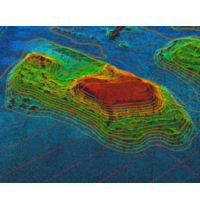
Photogrammetrie von Vermessern für Vermesser
[/fusion_text][/fusion_builder_column_inner][fusion_builder_column_inner type=“1_2″ layout=“1_2″ spacing=““ center_content=“no“ hover_type=“none“ link=“https://staging.caddy-geomatics.de/software/caddy-classic-v/“ min_height=““ hide_on_mobile=“small-visibility,medium-visibility,large-visibility“ class=““ id=““ background_color=““ background_image=““ background_position=“left top“ undefined=““ background_repeat=“no-repeat“ border_size=“1″ border_color=“#efefef“ border_style=“solid“ padding_top=““ padding_right=““ padding_bottom=““ padding_left=““ margin_top=““ margin_bottom=““ animation_type=““ animation_direction=“left“ animation_speed=“0.3″ animation_offset=““ last=“no“ border_position=“all“][fusion_text columns=““ column_min_width=““ column_spacing=““ rule_style=“default“ rule_size=““ rule_color=““ class=““ id=““]
CADdy Classic
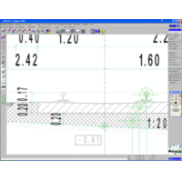
Die klassische CAD Vermessungslösung
[/fusion_text][/fusion_builder_column_inner][/fusion_builder_row_inner][fusion_builder_row_inner][fusion_builder_column_inner type=“1_2″ layout=“1_2″ spacing=““ center_content=“no“ hover_type=“none“ link=“https://staging.caddy-geomatics.de/software/webcaddy/“ min_height=“none“ hide_on_mobile=“small-visibility,medium-visibility,large-visibility“ class=““ id=““ background_color=““ background_image=““ background_position=“left top“ undefined=““ background_repeat=“no-repeat“ border_size=“1″ border_color=“#efefef“ border_style=“solid“ padding_top=““ padding_right=““ padding_bottom=““ padding_left=““ margin_top=““ margin_bottom=““ animation_type=““ animation_direction=“left“ animation_speed=“0.3″ animation_offset=“top-mid-of-view“ last=“no“ border_position=“all“][fusion_text columns=““ column_min_width=““ column_spacing=““ rule_style=“default“ rule_size=““ rule_color=““ class=““ id=““]
WebCADdy
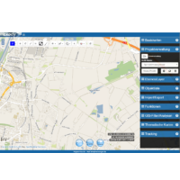
Die Cloud GIS/CAD -Anwendung zur Datenerfassung und Verarbeitung
[/fusion_text][/fusion_builder_column_inner][fusion_builder_column_inner type=“1_2″ layout=“1_2″ spacing=““ center_content=“no“ hover_type=“none“ link=“https://staging.caddy-geomatics.de/software/caddy-bricscad/“ min_height=““ hide_on_mobile=“small-visibility,medium-visibility,large-visibility“ class=““ id=““ background_color=““ background_image=““ background_position=“left top“ undefined=““ background_repeat=“no-repeat“ border_size=“1″ border_color=“#efefef“ border_style=“solid“ padding_top=““ padding_right=““ padding_bottom=““ padding_left=““ margin_top=““ margin_bottom=““ animation_type=““ animation_direction=“left“ animation_speed=“0.3″ animation_offset=““ last=“no“ border_position=“all“][fusion_text columns=““ column_min_width=““ column_spacing=““ rule_style=“default“ rule_size=““ rule_color=““ class=““ id=““]
CADdy for BricsCAD
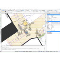
CADdy Vermessung goes DWG
[/fusion_text][/fusion_builder_column_inner][/fusion_builder_row_inner][/fusion_builder_column][fusion_builder_column type=“1_2″ layout=“1_2″ spacing=““ center_content=“no“ link=““ target=“_self“ min_height=““ hide_on_mobile=“small-visibility,medium-visibility,large-visibility“ class=““ id=““ background_color=“#f8f8f8″ background_image=““ background_position=“left top“ undefined=““ background_repeat=“no-repeat“ hover_type=“none“ border_size=“1″ border_color=“#efefef“ border_style=“solid“ border_position=“all“ padding_top=““ padding_right=““ padding_bottom=““ padding_left=““ margin_top=““ margin_bottom=““ animation_type=““ animation_direction=“left“ animation_speed=“0.3″ animation_offset=““ last=“no“][fusion_title margin_top=““ margin_bottom=“-10px“ hide_on_mobile=“small-visibility,medium-visibility,large-visibility“ class=““ id=““ size=“2″ content_align=“center“ style_type=“none“ sep_color=““]
Dienstleistungen
[/fusion_title][fusion_builder_row_inner][fusion_builder_column_inner type=“1_2″ layout=“1_2″ spacing=““ center_content=“no“ hover_type=“none“ link=“https://staging.caddy-geomatics.de/dienstleistungen/consulting/“ min_height=“none“ hide_on_mobile=“small-visibility,medium-visibility,large-visibility“ class=““ id=““ background_color=““ background_image=““ background_position=“left top“ undefined=““ background_repeat=“no-repeat“ border_size=“1″ border_color=“#efefef“ border_style=“solid“ padding_top=““ padding_right=““ padding_bottom=““ padding_left=““ margin_top=““ margin_bottom=““ animation_type=““ animation_direction=“left“ animation_speed=“0.3″ animation_offset=“top-mid-of-view“ last=“no“ border_position=“all“][fusion_text columns=““ column_min_width=““ column_spacing=““ rule_style=“default“ rule_size=““ rule_color=““ class=““ id=““]
Consulting

Mit uns finden Sie immer die passende Lösung
[/fusion_text][/fusion_builder_column_inner][fusion_builder_column_inner type=“1_2″ layout=“1_2″ spacing=““ center_content=“no“ hover_type=“none“ link=“https://staging.caddy-geomatics.de/dienstleistungen/service/“ min_height=“none“ hide_on_mobile=“small-visibility,medium-visibility,large-visibility“ class=““ id=““ background_color=““ background_image=““ background_position=“left top“ undefined=““ background_repeat=“no-repeat“ border_size=“1″ border_color=“#efefef“ border_style=“solid“ padding_top=““ padding_right=““ padding_bottom=““ padding_left=““ margin_top=““ margin_bottom=““ animation_type=““ animation_direction=“left“ animation_speed=“0.3″ animation_offset=““ last=“no“ border_position=“all“][fusion_text columns=““ column_min_width=““ column_spacing=““ rule_style=“default“ rule_size=““ rule_color=““ class=““ id=““]
Service

Wir unterstützen Sie bei Ihren Projekten
[/fusion_text][/fusion_builder_column_inner][/fusion_builder_row_inner][fusion_builder_row_inner][fusion_builder_column_inner type=“1_2″ layout=“1_2″ spacing=““ center_content=“no“ hover_type=“none“ link=“https://staging.caddy-geomatics.de/dienstleistungen/development/“ min_height=““ hide_on_mobile=“small-visibility,medium-visibility,large-visibility“ class=““ id=““ background_color=““ background_image=““ background_position=“left top“ undefined=““ background_repeat=“no-repeat“ border_size=“1″ border_color=“#efefef“ border_style=“solid“ padding_top=““ padding_right=““ padding_bottom=““ padding_left=““ margin_top=““ margin_bottom=““ animation_type=““ animation_direction=“left“ animation_speed=“0.3″ animation_offset=“top-mid-of-view“ last=“no“ border_position=“all“][fusion_text columns=““ column_min_width=““ column_spacing=““ rule_style=“default“ rule_size=““ rule_color=““ class=““ id=““]
Development

Wir erstellen Ihre maßgeschneiderte Lösung
[/fusion_text][/fusion_builder_column_inner][fusion_builder_column_inner type=“1_2″ layout=“1_2″ spacing=““ center_content=“no“ hover_type=“none“ link=“https://staging.caddy-geomatics.de/dienstleistungen/geodaten/“ min_height=““ hide_on_mobile=“small-visibility,medium-visibility,large-visibility“ class=““ id=““ background_color=““ background_image=““ background_position=“left top“ undefined=““ background_repeat=“no-repeat“ border_size=“1″ border_color=“#efefef“ border_style=“solid“ padding_top=““ padding_right=““ padding_bottom=““ padding_left=““ margin_top=““ margin_bottom=““ animation_type=““ animation_direction=“left“ animation_speed=“0.3″ animation_offset=““ last=“no“ border_position=“all“][fusion_text columns=““ column_min_width=““ column_spacing=““ rule_style=“default“ rule_size=““ rule_color=““ class=““ id=““]
Geodaten

Mit uns haben Sie die besseren Karten
[/fusion_text][/fusion_builder_column_inner][/fusion_builder_row_inner][/fusion_builder_column][fusion_builder_column type=“1_2″ layout=“1_2″ spacing=““ center_content=“no“ link=““ target=“_self“ min_height=““ hide_on_mobile=“small-visibility,medium-visibility,large-visibility“ class=““ id=““ background_color=“#f8f8f8″ background_image=““ background_position=“left top“ undefined=““ background_repeat=“no-repeat“ hover_type=“none“ border_size=“1″ border_color=“#efefef“ border_style=“solid“ border_position=“all“ padding_top=““ padding_right=““ padding_bottom=““ padding_left=““ margin_top=““ margin_bottom=““ animation_type=““ animation_direction=“left“ animation_speed=“0.3″ animation_offset=““ last=“no“][fusion_title margin_top=““ margin_bottom=“-10px“ hide_on_mobile=“small-visibility,medium-visibility,large-visibility“ class=““ id=““ size=“2″ content_align=“center“ style_type=“none“ sep_color=““]
Hardware
[/fusion_title][fusion_builder_row_inner][fusion_builder_column_inner type=“1_2″ layout=“1_2″ spacing=““ center_content=“no“ hover_type=“none“ link=“https://staging.caddy-geomatics.de/caddy-sensors/uav/“ min_height=““ hide_on_mobile=“small-visibility,medium-visibility,large-visibility“ class=““ id=““ background_color=““ background_image=““ background_position=“left top“ undefined=““ background_repeat=“no-repeat“ border_size=“1″ border_color=“#efefef“ border_style=“solid“ padding_top=““ padding_right=““ padding_bottom=““ padding_left=““ margin_top=““ margin_bottom=““ animation_type=““ animation_direction=“left“ animation_speed=“0.3″ animation_offset=“top-mid-of-view“ last=“no“ border_position=“all“][fusion_text]
UAVs
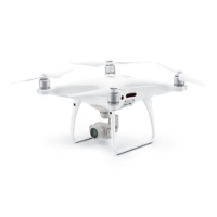
Konsumerdrohnen im
Vermessungseinsatz
[/fusion_text][/fusion_builder_column_inner][fusion_builder_column_inner type=“1_2″ layout=“1_2″ spacing=““ center_content=“no“ hover_type=“none“ link=“https://staging.caddy-geomatics.de/caddy-sensors/messboote/“ min_height=““ hide_on_mobile=“small-visibility,medium-visibility,large-visibility“ class=““ id=““ background_color=““ background_image=““ background_position=“left top“ undefined=““ background_repeat=“no-repeat“ border_size=“1″ border_color=“#efefef“ border_style=“solid“ padding_top=““ padding_right=““ padding_bottom=““ padding_left=““ margin_top=““ margin_bottom=““ animation_type=““ animation_direction=“left“ animation_speed=“0.3″ animation_offset=““ last=“no“ border_position=“all“][fusion_text]
Messboote
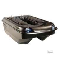
Automatisierte Unterwasservermessung
[/fusion_text][/fusion_builder_column_inner][/fusion_builder_row_inner][fusion_builder_row_inner][fusion_builder_column_inner type=“1_2″ layout=“1_2″ spacing=““ center_content=“no“ hover_type=“none“ link=“https://staging.caddy-geomatics.de/caddy-sensors/gnss-by-stonex/“ min_height=““ hide_on_mobile=“small-visibility,medium-visibility,large-visibility“ class=““ id=““ background_color=““ background_image=““ background_position=“left top“ undefined=““ background_repeat=“no-repeat“ border_size=“1″ border_color=“#efefef“ border_style=“solid“ padding_top=““ padding_right=““ padding_bottom=““ padding_left=““ margin_top=““ margin_bottom=““ animation_type=““ animation_direction=“left“ animation_speed=“0.3″ animation_offset=“top-mid-of-view“ last=“no“ border_position=“all“][fusion_text columns=““ column_min_width=““ column_spacing=““ rule_style=“default“ rule_size=““ rule_color=““ class=““ id=““]
GNSS
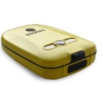
Einfach Messen
[/fusion_text][/fusion_builder_column_inner][fusion_builder_column_inner type=“1_2″ layout=“1_2″ spacing=““ center_content=“no“ hover_type=“none“ link=“https://staging.caddy-geomatics.de/caddy-sensors/zubehoer/“ min_height=““ hide_on_mobile=“small-visibility,medium-visibility,large-visibility“ class=““ id=““ background_color=““ background_image=““ background_position=“left top“ undefined=““ background_repeat=“no-repeat“ border_size=“1″ border_color=“#efefef“ border_style=“solid“ padding_top=““ padding_right=““ padding_bottom=““ padding_left=““ margin_top=““ margin_bottom=““ animation_type=““ animation_direction=“left“ animation_speed=“0.3″ animation_offset=““ last=“no“ border_position=“all“][fusion_text columns=““ column_min_width=““ column_spacing=““ rule_style=“default“ rule_size=““ rule_color=““ class=““ id=““]
Zubehör
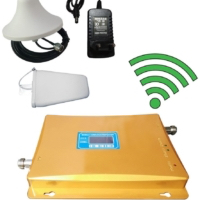
Wir helfen der Technik
auf die Sprünge
[/fusion_text][/fusion_builder_column_inner][/fusion_builder_row_inner][/fusion_builder_column][fusion_builder_column type=“1_2″ layout=“1_2″ spacing=““ center_content=“no“ link=““ target=“_self“ min_height=““ hide_on_mobile=“small-visibility,medium-visibility,large-visibility“ class=““ id=““ background_color=“#f8f8f8″ background_image=““ background_position=“left top“ undefined=““ background_repeat=“no-repeat“ hover_type=“none“ border_size=“1″ border_color=“#efefef“ border_style=“solid“ border_position=“all“ padding_top=““ padding_right=““ padding_bottom=““ padding_left=““ margin_top=““ margin_bottom=““ animation_type=““ animation_direction=“left“ animation_speed=“0.3″ animation_offset=““ last=“no“][fusion_title margin_top=““ margin_bottom=“-10px“ hide_on_mobile=“small-visibility,medium-visibility,large-visibility“ class=““ id=““ size=“2″ content_align=“center“ style_type=“none“ sep_color=““]
Akademie
[/fusion_title][fusion_builder_row_inner][fusion_builder_column_inner type=“1_2″ layout=“1_2″ spacing=““ center_content=“no“ hover_type=“none“ link=“https://staging.caddy-geomatics.de/akademie/flying-surveyor/“ min_height=““ hide_on_mobile=“small-visibility,medium-visibility,large-visibility“ class=““ id=““ background_color=““ background_image=““ background_position=“left top“ undefined=““ background_repeat=“no-repeat“ border_size=“1″ border_color=“#efefef“ border_style=“solid“ padding_top=““ padding_right=““ padding_bottom=““ padding_left=““ margin_top=““ margin_bottom=““ animation_type=““ animation_direction=“left“ animation_speed=“0.3″ animation_offset=“top-mid-of-view“ last=“no“ border_position=“all“][fusion_text columns=““ column_min_width=““ column_spacing=““ rule_style=“default“ rule_size=““ rule_color=““ class=““ id=““]
Flying Surveyor

Von der Befliegung zur cm-Koordinate
[/fusion_text][/fusion_builder_column_inner][fusion_builder_column_inner type=“1_2″ layout=“1_2″ spacing=““ center_content=“no“ hover_type=“none“ link=“https://staging.caddy-geomatics.de/akademie/“ min_height=““ hide_on_mobile=“small-visibility,medium-visibility,large-visibility“ class=““ id=““ background_color=““ background_image=““ background_position=“left top“ undefined=““ background_repeat=“no-repeat“ border_size=“1″ border_color=“#efefef“ border_style=“solid“ padding_top=““ padding_right=““ padding_bottom=““ padding_left=““ margin_top=““ margin_bottom=““ animation_type=““ animation_direction=“left“ animation_speed=“0.3″ animation_offset=““ last=“no“ border_position=“all“][fusion_text columns=““ column_min_width=““ column_spacing=““ rule_style=“default“ rule_size=““ rule_color=““ class=““ id=““]
Learn&Earn Software
3Dsurvey | BricsCAD | CADdy Classic | WebCADdy
[/fusion_text][/fusion_builder_column_inner][/fusion_builder_row_inner][fusion_builder_row_inner][fusion_builder_column_inner type=“1_2″ layout=“1_2″ spacing=““ center_content=“no“ hover_type=“none“ link=“https://staging.caddy-geomatics.de/akademie/schulungen-seminare/learn-earn-gnss/“ min_height=““ hide_on_mobile=“small-visibility,medium-visibility,large-visibility“ class=““ id=““ background_color=““ background_image=““ background_position=“left top“ undefined=““ background_repeat=“no-repeat“ border_size=“1″ border_color=“#efefef“ border_style=“solid“ padding_top=““ padding_right=““ padding_bottom=““ padding_left=““ margin_top=““ margin_bottom=““ animation_type=““ animation_direction=“left“ animation_speed=“0.3″ animation_offset=“top-mid-of-view“ last=“no“ border_position=“all“][fusion_text columns=““ column_min_width=““ column_spacing=““ rule_style=“default“ rule_size=““ rule_color=““ class=““ id=““]
Learn&Earn GNSS

Hardware und Software wie füreinander gemacht
[/fusion_text][/fusion_builder_column_inner][fusion_builder_column_inner type=“1_2″ layout=“1_2″ spacing=““ center_content=“no“ hover_type=“none“ link=“https://staging.caddy-geomatics.de/akademie/swimmingsurveyor/“ min_height=““ hide_on_mobile=“small-visibility,medium-visibility,large-visibility“ class=““ id=““ background_color=““ background_image=““ background_position=“left top“ undefined=““ background_repeat=“no-repeat“ border_size=“1″ border_color=“#efefef“ border_style=“solid“ padding_top=““ padding_right=““ padding_bottom=““ padding_left=““ margin_top=““ margin_bottom=““ animation_type=““ animation_direction=“left“ animation_speed=“0.3″ animation_offset=““ last=“no“ border_position=“all“][fusion_text columns=““ column_min_width=““ column_spacing=““ rule_style=“default“ rule_size=““ rule_color=““ class=““ id=““]
Swimming Surveyor
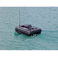
automatisierte Unterwasservermessung
[/fusion_text][/fusion_builder_column_inner][/fusion_builder_row_inner][/fusion_builder_column][/fusion_builder_row][/fusion_builder_container][fusion_builder_container admin_label=“Intro“ hundred_percent=“no“ hundred_percent_height=“no“ hundred_percent_height_scroll=“no“ hundred_percent_height_center_content=“yes“ equal_height_columns=“no“ menu_anchor=““ hide_on_mobile=“no“ class=““ id=““ background_color=“rgba(255,255,255,0)“ background_image=““ background_position=“left top“ background_repeat=“no-repeat“ fade=“no“ background_parallax=“none“ enable_mobile=“no“ parallax_speed=“0.3″ video_mp4=““ video_webm=““ video_ogv=““ video_url=““ video_aspect_ratio=“16:9″ video_loop=“yes“ video_mute=“yes“ video_preview_image=““ border_size=“0px“ border_color=““ border_style=“solid“ margin_top=““ margin_bottom=““ padding_top=“100px“ padding_right=““ padding_bottom=“4%“ padding_left=““][fusion_builder_row][fusion_builder_column type=“1_6″ layout=“1_6″ spacing=“yes“ center_content=“no“ hover_type=“none“ link=““ min_height=““ hide_on_mobile=“yes“ class=““ id=““ background_color=““ background_image=““ background_position=“left top“ undefined=““ background_repeat=“no-repeat“ border_size=“0″ border_color=““ border_style=“solid“ border_position=“all“ padding_top=““ padding_right=““ padding_bottom=““ padding_left=““ margin_top=““ margin_bottom=““ animation_type=““ animation_direction=“down“ animation_speed=“0.1″ animation_offset=““ last=“no“][/fusion_builder_column][fusion_builder_column type=“2_3″ layout=“2_3″ spacing=“yes“ center_content=“no“ hover_type=“none“ link=““ min_height=““ hide_on_mobile=“no“ class=““ id=““ background_color=““ background_image=““ background_position=“left top“ undefined=““ background_repeat=“no-repeat“ border_size=“0″ border_color=““ border_style=“solid“ border_position=“all“ padding_top=““ padding_right=““ padding_bottom=““ padding_left=““ margin_top=““ margin_bottom=“30px“ animation_type=““ animation_direction=“left“ animation_speed=“0.1″ animation_offset=““ last=“no“][fusion_imageframe image_id=“1961″ max_width=““ style_type=“none“ stylecolor=““ hover_type=“none“ bordersize=“0px“ bordercolor=““ borderradius=“0″ align=“center“ lightbox=“no“ gallery_id=““ lightbox_image=““ alt=“CADdy Geomatics Logo“ link=““ linktarget=“_blank“ hide_on_mobile=“no“ class=““ id=““ animation_type=““ animation_direction=“down“ animation_speed=“0.1″ animation_offset=““]https://staging.caddy-geomatics.de/wp-content/uploads/2018/03/cropped-caddy_logo-sticky_114x114px.png[/fusion_imageframe][fusion_separator style_type=“none“ top_margin=“40″ alignment=“center“ /][fusion_text]
CADdy Geomatics News
[/fusion_text][fusion_text]
News zum Thema CAD in der Vermessung, Rechtliches und Allgemeines
[/fusion_text][fusion_separator style_type=“single solid“ hide_on_mobile=“small-visibility,medium-visibility,large-visibility“ class=““ id=““ sep_color=“#18579e“ top_margin=“15px“ bottom_margin=“35px“ border_size=“1px“ icon=““ icon_circle=““ icon_circle_color=““ width=“170px“ alignment=“center“ /][/fusion_builder_column][fusion_builder_column type=“1_6″ layout=“1_6″ spacing=“yes“ center_content=“no“ hover_type=“none“ link=““ min_height=““ hide_on_mobile=“yes“ class=““ id=““ background_color=““ background_image=““ background_position=“left top“ undefined=““ background_repeat=“no-repeat“ border_size=“0″ border_color=““ border_style=“solid“ border_position=“all“ padding_top=““ padding_right=““ padding_bottom=““ padding_left=““ margin_top=““ margin_bottom=““ animation_type=““ animation_direction=“down“ animation_speed=“0.1″ animation_offset=““ last=“no“][fusion_separator style_type=“none“ top_margin=“20″ alignment=“center“ /][/fusion_builder_column][fusion_builder_column type=“1_1″ layout=“1_1″ spacing=““ center_content=“yes“ link=““ target=“_self“ min_height=““ hide_on_mobile=“small-visibility,medium-visibility,large-visibility“ class=““ id=““ background_color=““ background_image=““ background_position=“left top“ undefined=““ background_repeat=“no-repeat“ hover_type=“none“ border_size=“0″ border_color=““ border_style=“solid“ border_position=“all“ padding_top=““ padding_right=““ padding_bottom=““ padding_left=““ margin_top=““ margin_bottom=““ animation_type=““ animation_direction=“left“ animation_speed=“0.3″ animation_offset=““ last=“no“][fusion_recent_posts layout=“default“ hover_type=“none“ columns=“3″ number_posts=“3″ offset=“0″ pull_by=“category“ cat_slug=““ exclude_cats=““ tag_slug=““ exclude_tags=““ thumbnail=“yes“ title=“yes“ meta=“yes“ meta_author=“yes“ meta_categories=“no“ meta_date=“yes“ meta_comments=“yes“ meta_tags=“no“ content_alignment=““ excerpt=“no“ excerpt_length=“35″ strip_html=“yes“ scrolling=“pagination“ hide_on_mobile=“small-visibility,medium-visibility,large-visibility“ class=““ id=““ animation_type=““ animation_direction=“left“ animation_speed=“0.3″ animation_offset=““ /][/fusion_builder_column][/fusion_builder_row][/fusion_builder_container]